Swineshead Places
Swineshead
A proposal for conservation within the parish.
Prepared 2001 by the Swineshead Parish Council in conjunction with the Swineshead Conservation Association and Boston Borough Council Conservation Department.
|
|||
| Click on thumbnail to view larger version. | |||
High Street
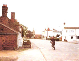
Much of the historic High Street still remains, most modern additions being set back from the road to retain the character of the place whether viewed from the north or south end. Typically a mix of architectural styles the section of the High Street which is currently outside of the existing conservation area contains buildings important to the history of the village, some commercial and others residential. Each has a landmark quality which enhances the view from the north toward the church and toward the important junctions of the High Street contains the listed Wesleyan Chapel and there are also other sites which might be considered for listing.
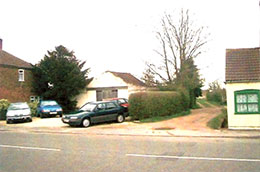
There are also important spaces remaining along the High Street, field entrances which are characteristic of the village's horticultural history. One at the south end gives views over fields toward the west which are important to the conservation area itself. Another at the north end provides the only remaining view of the Manwarings from the High Street. A track entrance mid-way along on the east side is much-used by residents for recreational purposes and as a route to the Manwarings footpath.
Introduction
The village of Swineshead has a long history. The site of a Norman motte and Bailey Castle which may have its origins as an earlier Danish encampment, the Manwar Ings is a scheduled Ancient Monument. During the Middle Ages, Swineshead was home to one of the great Cistercian houses of England until the dissolution of the monasteries in the Sixteenth Century, after which the stones of the Abbey were re-used to build a grand house, now itself enjoying the protected status of a listed building. Swineshead's fine parish church, dating from the Fourteenth Century, is a Grade I listed building at the heart of the current conservation area designated in 1982. Also included are the remains of the ancient market cross, the Wheatsheaf Hotel and its neighbour, Bank House, The Hall, a row of Eighteenth Century buildings, the old vicarage and a former brewery.
All these buildings and sites are now protected in one form or another but, important as these are, there remain many more buildings of historic or architectural interest outside the existing conservation area and these enjoy no legal protection against inappropriate development or even demolition.
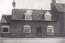
Some of the village's fine heritage has already been lost. The old black-and-white photographs contained in these albums - taken mostly in the early years of the Twentieth Century - testify to that. Yet, side by side with the colour photographs of today's village, these old views show just how much has survived. There are probably over 50 unlisted buildings (or groups of buildings) which date from 1887 or earlier, lying outside the existing conservation area. Of these, perhaps half have their origins before 1783. Many of these unprotected buildings lie on High Street,l around the small Jubilee Garden at the sould end of Tarry Hill, or in the North End - well outside the existing conservation area. The threat to the architectural features, settings and even the very existence of these buildings is evidenced by the development - large and small - which has taken place in the village in recent years and which continues apace. We believe that consideration should be given to enlarging the present conservation area to include many of these buildings or else to creating new conservation areas to encompass them. Otherwise, we fear that this wonderful heritage could be swamped by new development or lost altogether and the character of the village changed beyond recognition.
It is not only the older buildings of the village which are in need of protection - there are also spaces which need to be preserved. Swineshead is a linear village - in many places just one street wide. Through the few remaining gaps between buildings there are sweeping views across the fens towards distant hills to the west, and of the outlying settlements such as Swineshead Bridge, Drayton and Fenhouses - with their isolated farms and outbuildings punctuating the vastness of the fens.
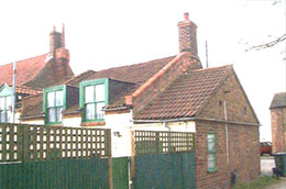
The albums are arranged by street or area, each with a short introduction preceding the photographs of individual buildings or spaces. It has not been possible to describe each building's architectural features in detail - we hope the photographs will serve to illustrate - but where special details about a building are knows, these are noted. Each building photographed has been given a unique reference number and this is used to denote its location on the accompanying maps.
We trust that the Borough of Boston will find this work helpful in its review of Swineshead's conservation area. We hope that the review will be radical in its approach and in its recommendations in order to acknowledge and protect the full scope of the heritage of our village correspond to buildings appearing on the 1783 plan or the 1887 map. Preliminary indications suggest that over 50 buildings may date from 1887 or earlier, about half of which may date from 1783 or earlier. |
|||
 |
|||
 |
|||
 |
|||
Dating Swineshead's Older Buildings from Historic Maps & Plans
Among the 'historic' maps and plans of Swineshead, there are two which show the road network and layout of buildings in the village in some detail. These are:
1) "A Plan of the Fen and other Low Lands in the Parish of Swineshead, 1783" (hereafter referred to as "The 1783 Plan"), and
2) Ordnance Survey 6" to 1 Mile, 1887, revised 1904, issued 1906 (hereafter referred to as "The 1887 Map").
The 1783 Plan is primarily designed to show the location of the new enclosures in the parish of Swineshead. It is quite well-detailed but suffers from two drawbacks:
The 1887 Map is the earliest map of the village which could be described as comprehensive. It shows the omplete road layout (with names) and buildings with their respective plots. Some buildings are named. Although issued in 1906, most details are thought to relate to 1887 when the map was originally drawn. This is evident from the fact that there are no buildings shown in Coles Lane despite the fact that the semi-detached houses at the eastern end are believed to date from the 1890's.
A comparison of these two historic maps with the current 'Explorer' O.S. Map (2½ inches to the mile) shows that the road layout in and around the village has barely altered at all over mor than 200 years with the obvious exception of the bypass opened in 1985. That apart, the pattern of roads, lanes, tracks, and paths identified on the 1783 plan remains virtually intact. The pattern of settlement along the main north/south artery is also recognisable to present-day inhabitants. In the North End, it began, as today, where the 18th Century turnpike road from Boston joined the old village road network by swinging abruptly from west to south. It continued via the triangular layout of the North End, along North Street (now Station Road) and Tarry Hill and then on to High Street. To the south of the village centre, there was more scattered development along South Street, quickly petering out towards Drayton as today.
This linear pattern of building development reflects the fact that the road network, as is the case with many fenland villages, tends to follow ridges of slightly higher ground to minimise the risk of flooding. The 1887 map shows no departures from this pattern and it was only in the 20th Century that housing developments began to be built in clusters rather than in a linear fashion along the established road pattern. Such developments are off Packhorse Lane. Bullen's Lane, and Townfield Lane, as well as the Hallfields Estate north-east of the village centre and Abbey Fields to the west of the High Street. Elsewhere, new developments have continued to be fitted into gaps along the existing road network.
It is inevitably difficult to identify the age of buildings accurately simply by looking at their exterior but the 1783 and 1887 maps do allow us to identify the approximate siting of buildings at that time. It is therefore possible that older properties on the site of buildings shown on these maps do in fact date from 1887, 1783, or earlier, although this could only be verified by more thorough research. Nevertheless, it provides a starting point by suggesting a surprisingly large number of old properties which may date from either period.
The plan dated April 1999 and based on the Ordnance Survey Map, illustrates the extent to which older buildings now in existence but outside the current conservation area. |
|||
 |
|||
 |
|||
 |
|||
 |
|||
|
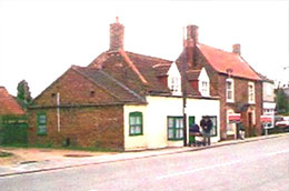
A 33 - Stoneleigh Location - opposite Weslyan Chapel |
|||
 |
|||
 |
|||
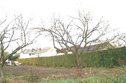
Buildings which may date from 1783 |
|||
C22 Swift Lodge C23 Owl Lodge B20 The Cottage, Tebbs Lane |
B14 Tarry Hill House |
||
 |
|||
 |
|||
Unlisted Buildings Assessment Checklist |
|||
For the purposes of assessing the buildings and sites listed here we have used notes from the Appendix of the English Heritage document 'Conservation Area Appraisals'. We have assigned a letter to each point mentioned so that, once familiar with the different criteria, the reader can see at a glance which criteria the building meets. The key is set out below.
Note: In English Heritage's view, any one of these characteristics could provide the basis for considering that a building makes a positive contribution to the special interest of a conservation area, provided that its historic form and qualities have not been seriously eroded by unsympathetic alteration. |
|||
 |
|||
 |
|||
 |
|||
|
|||


